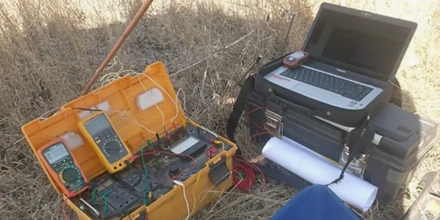
Regina sits at an elevation of 577 meters on a flat glacial lake plain where the subsurface tells a story written by Lake Agassiz. The city's 250,000 residents live above thick deposits of glaciolacustrine clay and till, and understanding the electrical properties of these formations is central to geotechnical work here. We use electrical resistivity tomography and vertical electrical sounding to map stratigraphic boundaries, locate perched water tables, and identify zones of saline groundwater long before an excavator breaks ground. In our experience, the contrast between saturated Regina clay and the underlying till produces a resistivity signature sharp enough to define competent bearing strata. A CPT test can validate these boundaries with point-specific penetration data, and when we need continuous profiling across a site, we combine the methods to reduce the number of boreholes required for a complete picture of the subsurface.
On the Regina plain, electrical resistivity is one of the few non-invasive methods that can distinguish clean till from saline, high-plasticity clay before a single borehole is advanced.
Local geotechnical context
The glaciolacustrine clays beneath Regina are electrically conductive, particularly where groundwater carries elevated total dissolved solids from Cretaceous shale bedrock deeper in the basin. The Bearpaw Formation, encountered at depth across much of the region, is a known source of saline water, and when that water migrates upward through fractures or sand interbeds, it creates low-resistivity anomalies that can be misinterpreted as pure clay if the interpreter lacks local calibration. A second risk is the presence of discontinuous sand lenses within the clay—if missed, these lenses act as preferential drainage paths that alter consolidation rates under load. We cross-reference every resistivity profile with available borehole logs and, where warranted, integrate the findings with a liquefaction assessment when sand bodies are identified at depths that fall within the zone of seismic influence defined by the NBCC for Regina.
Applicable standards
ASTM D6431 – Standard Guide for Using the Direct Current Resistivity Method for Subsurface Site Characterization, NBCC 2020 – National Building Code of Canada, seismic hazard provisions, CSA A23.3 – Design of Concrete Structures, exposure classes for sulfate attack, Canadian Foundation Engineering Manual (CFEM)
Common questions
What is the typical cost range for an electrical resistivity survey in Regina?
For a standard 2D ERT profile or a VES sounding suite on a residential to mid-size commercial lot, budgets in the Regina area generally fall between CA$880 and CA$1.560, depending on the length of the profile, the number of soundings, and the site access conditions. A detailed quote requires a review of the project scope and any existing geotechnical data.
Can resistivity reliably distinguish between dry clay and glacial till in the Regina area?
Yes, with an important caveat: the contrast is strongest when the clay is saturated and carries dissolved ions. Dry, desiccated clay can exhibit resistivities that overlap with the upper range of till. We typically calibrate the resistivity model against at least one borehole or a CPT sounding on the same site to anchor the geoelectrical boundaries to measured stratigraphy.
How deep can an electrical resistivity survey reach in the Regina glacial lake plain?
The effective depth of investigation is controlled by the array length and the background resistivity of the medium. In the conductive Regina clay, a Schlumberger array with a current-electrode spread of 300 meters typically resolves features down to 60–70 meters. For deeper targets, such as the top of the Bearpaw Formation, we extend the array and accept a coarser vertical resolution.