← Home · Slopes & Walls

Slope Stability Analysis in Regina: Preventing Failures in Glacial Lacustrine Soils

Together, we solve the challenges of tomorrow.

LEARN MORE →

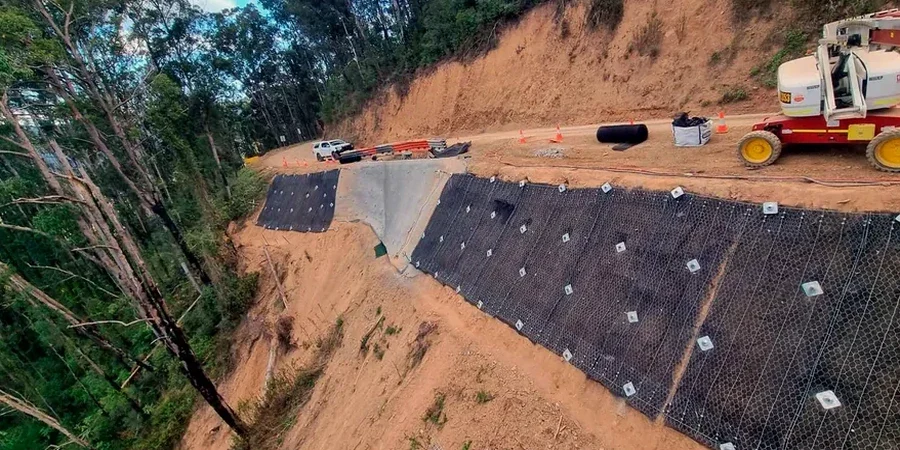
Regina sits on a deep basin of glacial Lake Regina sediments—mostly stiff, overconsolidated silty clays that look stable but can fail without warning when moisture content changes. Our team has inspected dozens of cut slopes along Wascana Creek and the bypass corridors where seasonal wetting-drying cycles trigger shallow sloughing. A proper slope stability analysis here requires more than a generic factor of safety calculation. The stiff Battleford Till and underlying Bearpaw Formation demand site-specific shear strength parameters and pore pressure modeling. For deep cuts in the city's expanding northeast sector, we often integrate the CPT test to capture continuous stratigraphy before defining failure surfaces in our models.

A slope that stands vertical at 4 meters in Regina's dry August may not survive the first spring thaw—saturation cuts the factor of safety by more than half.

Methodology and scope

Regina's climate swings from minus 40 in winter to plus 35 in July, and that thermal amplitude directly impacts slope performance. The upper 2 to 3 meters of glacial till freeze solid for five months a year, then thaw rapidly in April, creating transient perched water tables behind cut faces. Our analysis accounts for this by running drained and undrained scenarios at different saturation levels. The lake clays here have a plasticity index that often exceeds 25%, and we've measured residual friction angles dropping below 14 degrees in fully softened zones. When we encounter deep soft clay layers in the Regina Plain, we recommend combining slope analysis with stone columns for global stabilization before any toe excavation begins. We run models in Slide2 and Slope/W, checking both circular and block-type failures, and verify results against the City of Regina's geotechnical submission requirements for development permits.
Slope Stability Analysis in Regina: Preventing Failures in Glacial Lacustrine Soils
Technical reference image — Regina

Local geotechnical context

Our geologists walk the slope face with a hand penetrometer and a clinometer before any computer model is opened. In Regina's lacustrine clays, slickensides are common—polished shear surfaces that indicate past movement and residual strength conditions. Ignoring these features produces dangerously optimistic stability numbers. We also check for tension cracks at the crest. When those open up parallel to the slope edge, a translational failure is already in progress. The City of Regina requires a geotechnical stability report for any permanent cut exceeding 1.2 meters in height within the lacustrine clay zone, and we've seen developers lose months of schedule by submitting incomplete analyses that don't address the Bearpaw shale contact. Deep-seated failures here are rare but catastrophic—the 2011 Wascana Creek bank collapse moved 300 cubic meters overnight.

Need a geotechnical assessment?

Reply within 24h.

Email: info@geotechnicalengineering.vip

Typical values

ParameterTypical value
Analysis MethodLimit Equilibrium (Bishop, Spencer, Morgenstern-Price)
Soil Units ModeledBattleford Till, Bearpaw Formation, Condie Aquifer sediments
Groundwater ConditionSteady-state and transient seepage (spring thaw scenario)
Shear Strength InputPeak, fully softened, and residual from triaxial and ring shear
Seismic Coefficient0.05–0.10 per NBCC 2020 for Regina region
Typical Slope GeometryCut slopes 3:1 to 2:1; natural coulee slopes up to 8 m height
Factor of Safety TargetFS ≥ 1.5 (long-term), FS ≥ 1.3 (short-term construction)

Related services

01

Rotational Failure Analysis

Circular slip surface search using Bishop and Spencer methods, calibrated to triaxial CIU and ring shear test results on undisturbed Shelby tube samples from the Battleford Till.

02

Translational Block Analysis

Infinite slope and multi-block wedge models for shallow failures along the weathered till crust, with sensitivity analysis on perched water table elevation.

03

Seismic Slope Stability

Pseudostatic and Newmark displacement analyses using NBCC 2020 seismic hazard values for Regina, incorporating post-earthquake residual strength.

04

Remediation Design Review

Stability reassessment after slope flattening, toe berm construction, or horizontal drain installation, with updated factor of safety verification for regulatory sign-off.

Applicable standards

NBCC 2020 (National Building Code of Canada) — seismic hazard and geotechnical provisions, CSA A23.3 — Design of concrete structures with soil-structure interaction, City of Regina Development Standards — geotechnical submission requirements for slopes, Canadian Foundation Engineering Manual (CFEM 4th Ed.) — limit equilibrium methodology, ASTM D6467 — Torsional ring shear test for residual strength determination

Common questions

What triggers slope failures in Regina's soils?

Water is the primary trigger. Spring snowmelt and heavy summer storms saturate the upper glacial till, reducing matric suction and effective stress. The stiff Battleford Till contains vertical fissures that conduct water downward, raising pore pressure at depth. Erosion at the toe from Wascana Creek or drainage ditches also removes passive support, initiating progressive failure in the overconsolidated clay.

How long does a slope stability analysis take for a Regina development project?

A typical analysis for a single cut slope, including site inspection, laboratory shear strength testing on two to three samples, and modeling with a written report, takes 10 to 15 business days. Fast-track 7-day turnaround is available when drilling and lab data are already complete. Complex sites with multiple slope faces or deep Bearpaw Formation contacts may require 3 to 4 weeks for full 2D and 3D analysis.

What is the cost range for a slope stability analysis in Regina?

Slope stability analysis in Regina ranges from CA$1,720 for a simple existing slope assessment with existing soil data to CA$5,480 for a new cut design requiring additional site investigation, laboratory shear testing, and detailed computational modeling. The fee depends on slope height, number of cross-sections analyzed, and whether seismic or rapid drawdown scenarios are required.

Do I need a slope stability report for a building permit in Regina?

Yes, the City of Regina requires a geotechnical report addressing slope stability for any permanent excavation or fill slope exceeding 1.2 meters in height within the lacustrine clay zone, or any slope adjacent to a property line, public right-of-way, or watercourse. The report must demonstrate a minimum long-term factor of safety of 1.5 and be stamped by a professional engineer licensed in Saskatchewan.

Location and service area

We serve projects in Regina and surrounding areas.

View larger map